
Construction
Get periodic visual proof of progress — mapped, measured, and delivered on time.


Monitoring

How We Add Value
Gain control, ensure delivery: Our data-driven Construction Monitoring Solutions help you supervise, manage, and collaborate to keep every project on track.
DroneAxis enables comprehensive site monitoring across the full construction lifecycle, covering all phases from initial earthworks to final commissioning and handover.
DroneAxis delivers high-resolution visual documentation and precise quantitative analytics to track planned versus as-built progress with measurable accuracy.
DroneAxis facilitates data-backed vendor oversight for earthworks, EPC execution, and facade installation, enhancing accountability and performance tracking.
DroneAxis leverages high-resolution drone imagery and AI-driven processing to produce precise 2D and 3D digital twins of your construction site. Detailed aerial visuals enable clear, comprehensive inspections of every area. Our automated flight paths ensure uniform, standardized outputs on every visit, giving you accurate, repeatable data throughout the project lifecycle.
How DroneAxis Adds Value
Gain control, ensure delivery: Our data-driven Construction Monitoring Solutions help you supervise, manage, and collaborate to keep every project on track.
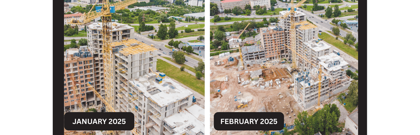
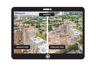
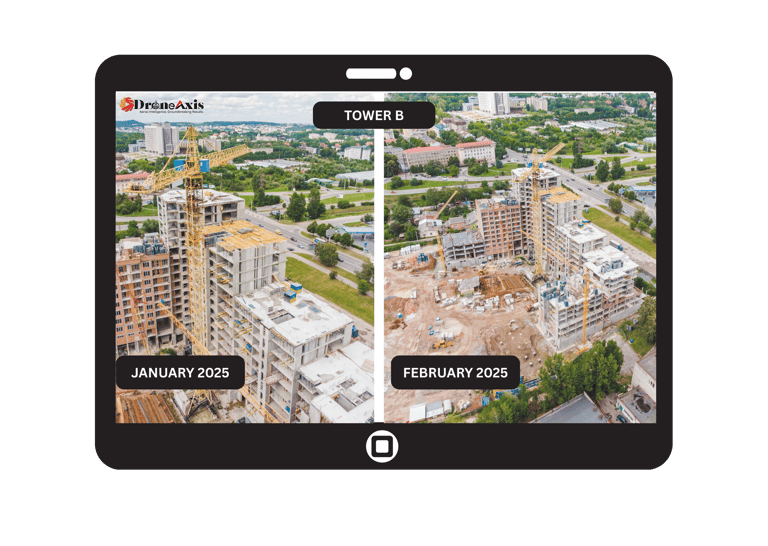
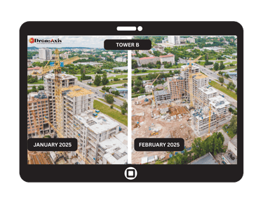
Scheduled Drone Monitoring
Get weekly or monthly aerial shoots that capture your project’s progress with precision.
DroneAxis delivers professional highlight videos ideal for marketing, management, and investor updates.
Progress Reports & Analytics


Receive detailed PDF reports aligned with your project terminology.
Each includes progress insights, comparisons, and visual analytics — ready to share with buyers or stakeholders.
Interactive 360° Virtual Tours
Receive detailed PDF reports aligned with your project terminology.
Each includes progress insights, comparisons, and visual analytics — ready to share with buyers or stakeholders.

Your Project. Crystal Clear
Regular Drone Shoots
Weekly or monthly aerial coverage capturing every project milestone.
Highlight Videos
Professional edits showcasing key progress for Customers, marketing and management.
Detailed PDF Reports
Custom progress reports aligned with your site terminology and data.
360° Virtual Tours
Interactive walkthroughs for remote monitoring and client presentations.
Project Timelapse
Seamless visual journey from start to completion of your construction.
3D Digital Twin
High-precision digital replica of your site for analysis and documentation.


Lets Connect !
Suman S
© 2025. All rights reserved.
DroneAxis is your one-stop solution for drone intelligence, construction monitoring, and business surveillance.”
suman@droneaxis.in
+91 9538507639
Founder & CEO
connect@droneaxis.in
💡Website designed & built by Suman S| Founder - DroneAxis

Registered Address -
Suman Ventures, DroneAxis.in, #M, 3rd Floor Sycon Workplace, MM Layout,
Kaval Bysandra, RT Nagar - 560032